The white spots on our nails are called leukonychia. Most of the times these are caused by some injury to the matrix of nails. Just like a bruise appears sometime after the injury to skin, the white spots also take few days to appear after an injury. These spots can also be a sign of some fungal infection in the nail bed or any allergic reaction to some products, like nail polish or nail polish remover.
Why is laughter considered the best medicine?
Actually, laughter and humor strengthen our immune system, boost energy and protect us from the damaging effects of stress. It is considered to be a priceless medicine which ia absolutely fun, free and easy to use. A good, hearty laugh relaxes our muscles for upto 45 minutes along with decreasing our stress hormones and increasing immune cells hence improving our resistance to diseases. It improves the function of blood vesels, increases blood flow which can help to protect us against heart attack.
Andman & Nicobar Islands
an introduction
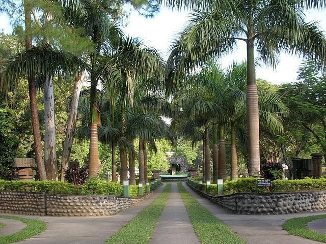
The Andaman and Nicobar Islands, located in the east of the Indian mainland geographically, float in splendid isolation in the Bay of Bengal. Once a hill range extending from Myanmar to Indonesia, these picturesque undulating islands, islets numbering around 572, are covered with dense rain-fed, damp and evergreen forests and endless varieties of exotic flora and fauna. Most of these islands (about 550) are in the Andaman Group, 28 of which are inhabited. The smaller Nicobars, comprise some 22 main islands (10 inhabited). The Andaman and Nicobars are separated by the Ten Degree Channel which is 150 Kms. wide.
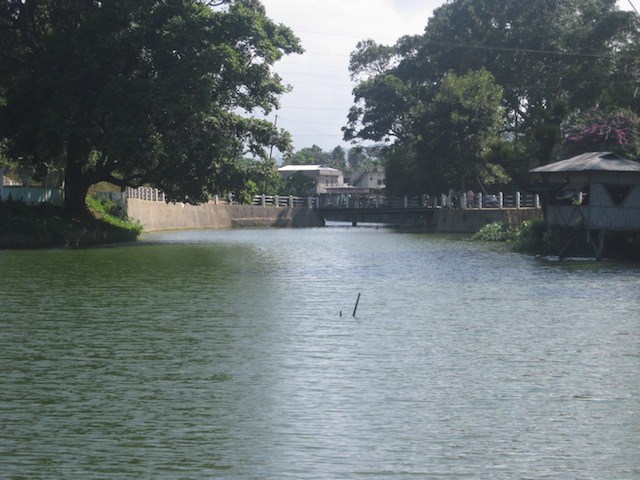
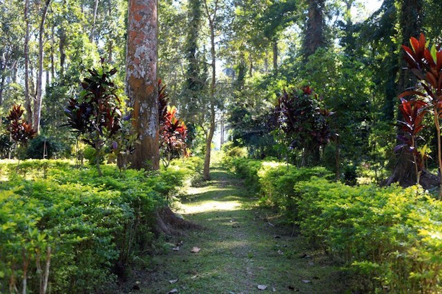
These islands also boast of freedom fighting days’ historically significant landmarks viz. Cellular Jail, Ross Island, Viper Island, Hopetown and Mount Harriet. The Andaman and Nicobar Islands have been declared as two of the 218 endemic bird area of the world. As many as 270 species and sub-species of birds have been reported existing in these islands, 106 of them being endemic. The Andaman Wood Pigeon, Andaman Padauk and Dugong are declared as State Bird, State Tree and State Animal respectively. There are about 96 Wildlife Sanctuaries, nine National Parks and one Biosphere Reserve in the islands. These islands are blessed with the bounties of both south-west and north-east monsoons
These islands also boast of freedom fighting days’ historically significant landmarks viz. Cellular Jail, Ross Island, Viper Island, Hopetown and Mount Harriet. The Andaman and Nicobar Islands have been declared as two of the 218 endemic bird area of the world. As many as 270 species and sub-species of birds have been reported existing in these islands, 106 of them being endemic. The Andaman Wood Pigeon, Andaman Padauk and Dugong are declared as State Bird, State Tree and State Animal respectively. There are about 96 Wildlife Sanctuaries, nine National Parks and one Biosphere Reserve in the islands. These islands are blessed with the bounties of both south-west and north-east monsoons
History
The Andaman & Nicobar Islands have been inhabited for several thousand years, at the very least. The earlier archaeological evidence yet documented goes back some 2,200 years; however, the indications from genetic, cultural and linguistic isolation studies point to habitation going back 30,000 – 60,000 years, well into the Middle Palaeolithic. In the Andaman Islands, the various Andamanese people maintained their separated existence through the vast majority of this time, diversifying into distinct linguistic, cultural and territorial groups. By the 1850s when they first came into sustained contact by outside groups, the indigenous people of Andamans were: the Great Andamanese, who collectively represented at least 10 distinct sub groups and languages; the Jarawa: the jungle (or Rutland Jarawa); the Onge; and the Sentinelese (the most isolated of all the groups). The indigenous peoples of the Nicobars (unrelated to the Andamanese) have a similarly isolated and lengthy association with the islands. There are two main groups: the Nicobarese, or Nicobari living throughout many of the islands; and the Shompen, restricted to the interior of Great Nicobar.
climate and geography
The islands have a tropical climate. The South-west Monsoon sets in Andaman Nicobar islands towards the end of May and the North-east Monsoon in November. There is no fury of hot summer, no chilling winter, no water clogging or traffic jams. For those who want to enjoy boating, swimming, snorkeling, sightseeing all 12 months is season. North Indians find relief from burning heat and chilling winter if they visit the island from May/June/July and in December/January. Season for nature lovers is May to December when forest is lush green and waterfalls are at their prime. Divers can enjoy the best during December to April and bird watchers during winter times.
Normal rainfall at Port Blair : 3900 mmMean Minimum Temperature : 23.2° C
Mean Maximum Temperature : 25° C
Mean relative Humidity : 80 %
Administration
Administratively, the Union Territory of the Andaman and Nicobar Islands has three revenue Districts. Port Blair- the capital and gateway to the islands lies in South Andaman Island and falls under South Andaman District. The latest North & Middle Andaman District with Mayabunder as headquarters lies separated from South Andaman District by a creek. Car Nicobar is the District Head quarter of Nicobar District. As per 2011 Census, the total population of Andaman & Nicobar stands 3,79,944 and the literacy rate is 86.27%.
Port Blair - The Capital of Andaman & Nicobar Islands
Port Blair is the capital of the Union Territory of Andaman & Nicobar Islands. Port Blair is the gateway to the pristine islands. Port Blair, an Island town offering water-based activities like snorkeling, scuba diving, sea-cruises, and glimpses of the history and culture of the region. The Aberdeen Bazaar forms the centre of the town.
Assam Tourism
Assam is one of the eight states in the Northeastern part of India. It is comprised mostly of the valleys of Brahmaputra and Barak. Assam and the rest of the Northeastern states are connected to the rest of the country via the Siliguri Corridor or the Chicken's Neck, a 22-kilometre small strip of land in West Bengal. Its other name is the Gateway to the Northeast, as it is the main connection to reach the other states in the Northeastern part of the country. The state also shares an international border with Bhutan and Bangladesh. The people, culture and traditions of Assam are similar to that of the South Eastern countries.
Legend and History of Assam
The state had different names before becoming known as Assam. The oldest name known is Pragjyotisha, it was found from Sanskrit records and supposedly covered the entire Brahmaputra Valley. This name was also mentioned in the epics of the Mahabharata and the Ramayana.
Later, the name Kamrupa came up, which supposedly covered the Western part of the state. This name was found in an inscription of Samudra Gupta and from the records of Hiuen Tsang, a Chinese pilgrim.
The name Assam was not even in use in the region until the Ahoms came to it. The Ahoms are a Shan tribe from Burma, they crossed the Patkai Range and conquered Assam. Other evidences state that the name Assam has some relations to the Tai and the Mongoloid people, mostly from other countries in Southeast Asia.
In fact, the Thai and Siamese people are referred to as Shan, a variation of Syam, but pronounced with an n as Burmese words ending in m are pronounced with an n. Syam was later changed to Asam, Ahom, Aham, Ahomiya and Axomiya.
A possible coinage of the name is Haa meaning land and Sham meaning Tai. Together, they mean the Land of the Tais. Another possible explanation is that in Tai, the word Cham means to be defeated and adding in the prefix A, it then meant undefeated or peerless.
Historically, from the Ancient Era during 350 AD, when Assam was referred to as Pragjyotisha and Kamrupa, it has been conquered by different dynasties. Salasthamba of the Mlechchha Dynasty ruled the region from 655 AD to 990 AD.
During the Medieval Era, the Khen Empire conquered Assam. But during the year of 1498, the Khens surrendered to Alauddin Hussein Shah and thus began the ruling of the Turks in Kamrupa. Other notable dynasties during this era are the Koch, Kachari, Chutia and Ahom.
In the Colonial Era, there was a surge of tea plantations in Assam. However, this was also the time when the first Anglo-Burmese War ensued in 1824. The war ended in 1826, after the Treaty of Yandabo was established. The treaty lasted until 1838 until the British annexed Assam.
Assam was first separated from Bengal during the year 1874. It was then known as the Assam Chief Commissionership. In 1905, it was established as a part of the new province of Eastern Bengal and Assam. It was only in 1912 that it became the Assam Province. In the year 1970, Assam was separated into several states to fulfil the national aspirations of the tribal people living in it.
Getting There
1. By Air - There is only one international airport in Assam, the Lokpriya Gopinath Bordoloi International Airport or also known as the Guwahati International Airport. The airport is located in Borjhar and it was named after Gopinath Bordoloi, the first Chief Minister of Assam after Independence. It provides international flights for both Paro and Bangkok. It also has many flights from the different cities in India. Here are some of the flight timings from the Delhi going to the Lokpriya Gopinath Bordoloi International Airport:
2. By Bus - There are no direct buses from Delhi, Kolkata or Mumbai to Assam. Your best option would be to reach Siliguri and from there, board a bus going to Guwahati. The North Bengal State Transport Corporation operates buses plying from Kolkata to Siliguri. Here are their timings:
If you're coming from Delhi, there are no direct buses that go to Siliguri. You can go to Kolkata and from there, board a bus going to Siliguri. Or you can board a bus going to Muzaffarpur, here's one timing I was able to find:
Assam Quick Facts
The state of Assam has three general seasons: winter, summer and monsoon. The best time to visit Assam is during the winter season, between the months of October to March. Temperatures during this time are between 8°C to 20°C. The mild climate is pleasant enough for sightseeing and even trekking. The Bhopal Bihu Festival or Harvest Festival of Assam is also held during January.
After the winter season, the summer season follows, which is between April to June. Temperatures range between 32°C to 38°C during these months. If you'd like to visit the wildlife parks of Assam, this is the best time to do so as the animals go to the bodies of water for some relief from the heat. Make sure that you bring your umbrella and light clothing with you as the climate is a bit hot.
The last season is the monsoon season, between July to September. Temperatures range between 28°C to 32°C. During this time, heavy rain showers and thunderstorms are rampant along Assam. It's not a good time to visit the region as it's not uncommon for flooding to occur as well.
Places to Visit in Assam
Assam can be divided into four divisions, namely: Lower Assam, North Assam, Central Assam and Barak Valley or Southern Assam. North Assam's divisional office is Tezpur. Lower Assam's divisional office is Panbazar. Central Assam's divisional office is Nagaon. Upper Assam's divisional office is Jorhat. Barak Valley's divisional office is Silchar. All these divisions are then sub-divided into different districts.
Lower Assam - This is also known as the Namoni Oxom Region. The largest city in Assam can be found here as well, Guwahati. This is also the first region you'd reach if you come from Siliguri. Here are some of the places that you can visit in Lower Assam:
1. Guwahati - This city is situated in the Southern bank of the Brahmaputra River. Its other name is the City of Temples because of the numerous temples you can find here. It is a major riverine port city and also one of the fastest growing cities in the country. There are many places to visit in Guwahati,some of the main attractions here are the following:
Religious
Religious
Nature
Central Assam - This consists of Karbi Anglong and North Cachar. This region is between the Lower Assam and North Assam regions. Below it lies the Barak Valley region. Here are some of the must visit places in Central Assam:
1. Tezpur - This is the largest city in Central Assam. It's also known as the Cultural Capital of Assam. The city is also considered as the cleanest one out of all the cities in Assam. Here are some of the attractions you can visit in Tezpur:
Religious
Wildlife
Nature
North Assam - This is also known as the Ujoni Oxom Region. It is comprised of the Dhemaji, Dibrugarh, Golaghat, Jorhat, Tinsukia, Lakhimpur and Sibsagar districts. Some of the must-visit places in North Assam are the following:
1. Dibrugarh - This is a city and also the headquarters of the Dibrugarh district of Assam. It is also known as the Tea City of India. The name Dibrugarh means a fort on the banks of the Dibaru River. You can find Dibrugarh on the Easternmost part of Assam. It's one of the fastest growing cities in the state. It is the centre of economic activities in the state with industries like oil and natural gases, tea, power generation, fertiliser and cottage. Here are some of the attractions in Dibrugarh:
Religious
2. Majuli - This is a large river island in the Brahmaputra River. In the 20th century, the island had about 1,250 square kilometres of land. However, due to erosion, the island occupies only 325 square kilometres of land now. It is formed by the Brahmaputra River in the South and the Subansiri River in the North. Here are some of the attractions in Majuli:
Satras
1. Silchar - This is the headquarters of the Cachar district of Assam. It is also the second largest city in the state. Back then, the region was known as Shiler Chor, referring to the bank of stones where ships and vessels dock to in here. Over time, Shiler Chor became Silchar. Here are some of the attractions in Silchar:
Religious
Lower Assam - You'd have plenty of options for hotels around Guwahati. Outside of it, you'd find a few guest houses and home stays which would have the basic facilities that you need. Here are some hotels in Guwahati:
Budget Hotels in Guwahati
Budget Hotel in Tezpur
North Assam - There are many accommodation options in Dibrugarh such as hotels and lodges. However, luxury hotels are quite rare in the city. In Majuli, there are some home stays that you can stay in.
Hotels in Dibrugarh
Hotels in Silchar
The cuisine in Assam is called Assamese. Its main features are the following:
Legend and History of Assam
The state had different names before becoming known as Assam. The oldest name known is Pragjyotisha, it was found from Sanskrit records and supposedly covered the entire Brahmaputra Valley. This name was also mentioned in the epics of the Mahabharata and the Ramayana.
Later, the name Kamrupa came up, which supposedly covered the Western part of the state. This name was found in an inscription of Samudra Gupta and from the records of Hiuen Tsang, a Chinese pilgrim.
The name Assam was not even in use in the region until the Ahoms came to it. The Ahoms are a Shan tribe from Burma, they crossed the Patkai Range and conquered Assam. Other evidences state that the name Assam has some relations to the Tai and the Mongoloid people, mostly from other countries in Southeast Asia.
In fact, the Thai and Siamese people are referred to as Shan, a variation of Syam, but pronounced with an n as Burmese words ending in m are pronounced with an n. Syam was later changed to Asam, Ahom, Aham, Ahomiya and Axomiya.
A possible coinage of the name is Haa meaning land and Sham meaning Tai. Together, they mean the Land of the Tais. Another possible explanation is that in Tai, the word Cham means to be defeated and adding in the prefix A, it then meant undefeated or peerless.
Historically, from the Ancient Era during 350 AD, when Assam was referred to as Pragjyotisha and Kamrupa, it has been conquered by different dynasties. Salasthamba of the Mlechchha Dynasty ruled the region from 655 AD to 990 AD.
During the Medieval Era, the Khen Empire conquered Assam. But during the year of 1498, the Khens surrendered to Alauddin Hussein Shah and thus began the ruling of the Turks in Kamrupa. Other notable dynasties during this era are the Koch, Kachari, Chutia and Ahom.
In the Colonial Era, there was a surge of tea plantations in Assam. However, this was also the time when the first Anglo-Burmese War ensued in 1824. The war ended in 1826, after the Treaty of Yandabo was established. The treaty lasted until 1838 until the British annexed Assam.
Assam was first separated from Bengal during the year 1874. It was then known as the Assam Chief Commissionership. In 1905, it was established as a part of the new province of Eastern Bengal and Assam. It was only in 1912 that it became the Assam Province. In the year 1970, Assam was separated into several states to fulfil the national aspirations of the tribal people living in it.
Getting There
1. By Air - There is only one international airport in Assam, the Lokpriya Gopinath Bordoloi International Airport or also known as the Guwahati International Airport. The airport is located in Borjhar and it was named after Gopinath Bordoloi, the first Chief Minister of Assam after Independence. It provides international flights for both Paro and Bangkok. It also has many flights from the different cities in India. Here are some of the flight timings from the Delhi going to the Lokpriya Gopinath Bordoloi International Airport:
- Indigo 6E 251 - Departs at 5:35 and arrives at 7:50. Flight duration is 2 and a half hours. Fare is at Rs. 3,791 per passenger.
- Air Asia I5 791 - Departs at 6:05 and arrives at 8:25. Flight duration is 2 and a half hours. Fare is at Rs. 3,791 per passenger.
- Jet Airways 9W 7160 - Departs at 14:05 and arrives at 16:40. Flight duration is 2 and a half hours. Fare is at Rs. 4,194 per passenger.
2. By Bus - There are no direct buses from Delhi, Kolkata or Mumbai to Assam. Your best option would be to reach Siliguri and from there, board a bus going to Guwahati. The North Bengal State Transport Corporation operates buses plying from Kolkata to Siliguri. Here are their timings:
- NBSTC Rocket Bus Service - This is a non-AC bus service from the NBSTC. This bus leaves at 8:00 pm and reaches Siliguri the next day at 10:00 am. Ticket fare is at Rs. 245 to Rs. 300 per passenger.
- NBSTC Royal Cruiser Bus Service - This is a Volvo bus service from the NBSTC. This bus also leaves at 8:00 am although it can be earlier. It reaches Siliguri at 10:00 am or 9:00 am. Fare is at Rs. 745 per passenger or more.
- Greenline (Volvo AC Seater Bus) - Departs at 7:00 pm and arrives at 6:30 am. Fare is at Rs. 1,200 per passenger.
- Shyamoli Paribahan (Volco AC Seater Bus) - Departs at 6:30 pm and arrives at 6:00 am. Fare is at Rs. 1,100 per passenger.
- Rajdhani Express (Non-AC Seater Bus) - Departs at 5:30 pm and arrives at 8:00 am. Fare is at Rs. 650 per passenger.
- Ghosh Travels (Non-AC Seater Bus) - Departs at 6:00 pm and arrives at 9:00 am. Fare is at Rs. 600 per passenger.
If you're coming from Delhi, there are no direct buses that go to Siliguri. You can go to Kolkata and from there, board a bus going to Siliguri. Or you can board a bus going to Muzaffarpur, here's one timing I was able to find:
- Shive Bhole Nath Travels (AC Seater/Sleeper) - Departs in Nangloi Metro Station at 7:00 pm and arrives at 3:30 pm. Fare is at Rs. 1,520 per passenger.
- Raj Bus Service (AC Seater/Sleeper) - Departs at 4:30 pm and arrives at 3:15 am. Fare is at Rs. 450 per passenger.
- Mitruka Pushparaj (AC Seater/Sleeper) - Departs at 8:15 pm and arrives at 6:00 am. Fare is at Rs. 500 per passenger.
- Jay Ram Krishna Bus Service (Non-AC Seater Bus) - Departs at 1:30 pm and arrives at 4:00 am. Fare is at Rs. 500 per passenger.
- Swapna Travels (Non-AC Seater Bus) - Departs at 1:30 pm and arrives at 3:00 am. Fare is at Rs. 540 per passenger.
- Avadh Assam Express Train No. 15910 - This train runs daily, departs at 7:45 and arrives at 3:00 the next day.
- North East Express Train No. 12506 - This train runs daily, departs at 6:45 and arrives at 16:50 the next day.
- Guwahati Rajdhani Train No. 12236 - This train runs on Tuesdays, departs at 9:25 and arrives at 19:00 the next day.
- Kanchanjanga Express Train No. 25657 - This train runs during Mondays, Wednesdays and Saturdays. It departs at 6:35 and arrives at 4:15 the next day.
- Guwahati Express Train No. 12509 - This train runs during Sundays, Fridays and Saturdays. It departs at 10:03 and arrives at 6:00 the next day.
- Saraighat Express Train No. 12345 - This train runs daily, departs at 15:50 and arrives at 9:35 the next day.
- Delhi > Agra > Kanpur > Lucknow > Faizabad > Darbhanga > Kishanganj > Siliguri > Guwahati/Assam.
- Delhi > Agra > Kanpur > Allahabad > Varanasi > Muzaffarpur > Kishanganj > Siliguri > Guwahati/Assam.
Assam Quick Facts
- Region - Northeast India
- Capital - Dispur
- Largest City - Guwahati
- Official Language - Assamese
- Other Languages - English, Bengali and Bodo
- Attractions - National Parks, Temples and Museums
The state of Assam has three general seasons: winter, summer and monsoon. The best time to visit Assam is during the winter season, between the months of October to March. Temperatures during this time are between 8°C to 20°C. The mild climate is pleasant enough for sightseeing and even trekking. The Bhopal Bihu Festival or Harvest Festival of Assam is also held during January.
After the winter season, the summer season follows, which is between April to June. Temperatures range between 32°C to 38°C during these months. If you'd like to visit the wildlife parks of Assam, this is the best time to do so as the animals go to the bodies of water for some relief from the heat. Make sure that you bring your umbrella and light clothing with you as the climate is a bit hot.
The last season is the monsoon season, between July to September. Temperatures range between 28°C to 32°C. During this time, heavy rain showers and thunderstorms are rampant along Assam. It's not a good time to visit the region as it's not uncommon for flooding to occur as well.
Places to Visit in Assam
Assam can be divided into four divisions, namely: Lower Assam, North Assam, Central Assam and Barak Valley or Southern Assam. North Assam's divisional office is Tezpur. Lower Assam's divisional office is Panbazar. Central Assam's divisional office is Nagaon. Upper Assam's divisional office is Jorhat. Barak Valley's divisional office is Silchar. All these divisions are then sub-divided into different districts.
Lower Assam - This is also known as the Namoni Oxom Region. The largest city in Assam can be found here as well, Guwahati. This is also the first region you'd reach if you come from Siliguri. Here are some of the places that you can visit in Lower Assam:
1. Guwahati - This city is situated in the Southern bank of the Brahmaputra River. Its other name is the City of Temples because of the numerous temples you can find here. It is a major riverine port city and also one of the fastest growing cities in the country. There are many places to visit in Guwahati,some of the main attractions here are the following:
Religious
- Kamakhya Temple - This is located in the Nilachal Hill in the Western part of Guwahati. It is one of the oldest temples in the 51 Shakti Pithas. The main temple is dedicated to the Goddess Kamakhya. It was built between the 8th and 17th centuries by various individuals. It is believed that the earliest temple in the complex was built by the Mlechchha Dynasty. In 1498, it is believed that Hussein Shah destroyed the temple complex. It was then again rebuilt by Naranarayan during the year 1565. The Ahoms also had some part in the reconstruction of the temple. According to the Kalika Purana, Kamakhya Temple is the place where Sati retires in secret to satisfy her amour with Lord Shiva. The temple is popular among pilgrims of Tantric worship, more so during the annual Ambubachi Mela Festival.
- Bhuvaneswari Temple - This temple is also located in the Nilachal Hill of Guwahati. It is located nearby the Kamakhya Temple. It's dedicated to the Goddess Bhuvaneswari. She is also 1 of the 10 Mahavidya goddesses, just like Goddess Kamakhya. She is also known as the Ruler of the Universe and the entire universe is considered as a part of her body.
- Basistha Ashram Temple - This temple was built by Ahom King Rajeshwar Singha in the year 1764. There's a cave inside the temple complex in which it is believed that Basistha or Vasistha meditated during his lifetime. You would also find a waterfall inside the ashram/temple complex which is another favourite attraction for tourists.
- Hayagriva Madhava Temple - You can find this 30 kms West of Guwahati. It's situated on the Monikut Hill of Hajo. The present temple was constructed by King Raghudeva Narayan in 1583. Although some evidences say that the original temple was constructed by the King of Pala Dynasty during the 6th century. The presiding deity here is Narasimha, an incarnation of Lord Vishnu. It is both a Hindu and Buddhist temple. Some Buddhists even believe that this is the temple where Buddha attained Nirvana.
- Ugro Tara Temple - This temple was built by Ahom King Siva Singha during 1752 AD. At the East of the temple, you can find the Jorepukhuri Tank. You can find the temple in the locality of Latasil. Legend has it that the navel of Sati fell to this region, hence the temple is dedicated to Goddess Tara.
- Umananda Temple - This temple is located on the Peacock Island of Brahmaputra River in Guwahati. This temple was built by Ahom King Gadadhar Singha during 1694 AD. It is believed that Shiva resided here in the form of Bhayananda. When Shiva was in meditation in this hillock, Kamadeva interrupted him and thus angered Shiva which in turn burned Kamadeva into ashes. Thus, the other name of this region is Bhasmacala.
- Navagraha Temple - You can find this in Chitrasal Hill in Guwahati. The temple has the nine shivalingams to represent the nine Celestial Bodies. It was Ahom King Rajeshwar Singha who built this temple in the 18th century. However, it has been renovated recently during 1923 to 1945.
- Janardana Temple - You can find this in the Shukleshwar Hillock near the Brahmaputra River. It is a temple dedicated to the Lord Buddha, although the architectural styles of the temple are both Hindu and Buddhist. The temple was renovated during the 17th century however it is believed to have been built much earlier.
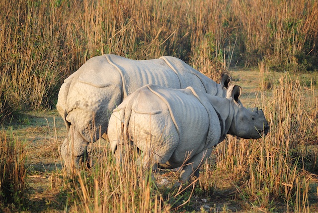
- Kaziranga National Park - This national park is located in both the Golaghat and Nagaon districts of Assam. It was built in 1905 as the Kaziranga Proposed Reserve Forest, which the main goal is to preserve the one-horned rhinos in the region. The park is home to the largest population of the world's one-horned rhino species. The park also has the largest numbers of the wild Asiatic water buffalo and Eastern swamp deer. The national park also has the highest density of tigers at about one tiger per five kms squared. Also, 9 of the 14 primate species in the country lives in the park.
- Manas National Park - This is contiguous with the Royal Manas National Park of Bhutan. The park is famous for its high population of the wild water buffalo species. The park was declared as a sanctuary during the year 1928, although it was a hunting ground for many years before that. Other animals that you can find in the park are the following: pygmy hog, Indian rhinoceros, sambar and Malayan giant squirrel.
- Assam State Zoo - This is the largest zoo in the state. There are about 895 animals here of about 113 different species. The zoo was established during 1957 and was opened to the public during 1958. You can see animals like one-horned rhinos, tigers, clouded leopards, golden langurs and Himalayan black bears here.
- Pobitora Wildlife Sanctuary - This is about 30 kms East of Guwahati. The sanctuary was declared as a reserve in 1971 and as a sanctuary in 1987. There are about 98 one-horned rhinos here, which is a 10% increase over the last 6 years. Aside from rhinos, you can also see leopards, wild boars, barking deers and wild buffalos here.
- Deepor Beel - You can find this in the Kamrup district of Assam, in the South West of Guwahati. This is a freshwater lake home to about 219 species of birds, 70 of which are migratory ones. Threatened species like the spot billed pelican, lesser adjutant stork and Pallas' sea eagle can also be spotted here. You can also find animals like elephants, leopards, barking deers and sambars here.
- Orang National Park - This was established as a wildlife sanctuary in 1985 and as a national park in 1999. You can find it within the Darrang and Sonitpur districts. There are about 68 one-horned rhinos here. You can also find the Royal Bengal tiger, Asiatic elephant and pygmy hog.
- Sankardev Kalashetra - This was built in the 1990's in order to preserve the cultural and artistic artefacts of the state. It was named after Srimanta Sankardev, a medieval poet, playwright and reformist. The Central Museum here displays the items used by the different ethnic groups of Assam. There's an open-air theatre as well where cultural programs are held. There's also a library, cultural village, heritage park, cable car facility and an exhibition centre inside the complex.
- Assam State Museum - You can find this near the Dighali Pukhuri Tank in Guwahati. It was established by the Assam Research Society during the 1940's. The museum has different sections showcasing sculptures, items and stenographic collections used during the ancient, medieval and colonial periods.
- Guwahati Planetarium - This is an astronomical research centre, featuring shows about astronomy and science. It's the most advanced planetarium in the state of Assam. There are daily shows about the solar system although they also conduct seminars and activities for students and science lovers. The planetarium also has a library section with books about space and terrestrial bodies. There are also plans of including a hybrid planetarium projection system in it, it would be the second to receive that, after the New Delhi Planetarium.
- Nehru Park - You can find this at the Panbazar area of Guwahati. The prestigious Cotton College is just adjacent to the park. There are also other educational institutions beside the park. Inside the park, you would see the 45 statues depicting the dance forms of Assam. There's also an open-air theatre, rock garden and lawn that you can visit.
Religious
- Bageshwari Temple - This temple is dedicated to Goddess Bageshwari, one of the oldest of the 51 Shakti Pithas. According to Hindu mythology, this is where the trishul of Goddess Durga fell when her body was cut into pieces by Lord Vishnu. There's a small artificial lake here, fed by a stream, which adds to the serenity of the temple.
- Lalmati Duramari Ganesh Temple - The origin of this temple is unknown, although evidences claim that it was built between the 8th to 10th centuries. The temple is mostly in ruins and it's not sure what has caused the destruction. Some believe that an earthquake caused it while others believe that Kalahapar destroyed it. During 1974, the government did some excavations around the site and found idols of gods and goddesses. Now, a community hall and office had been built on site and there are on going works for the building of a water tank.
- Kachugaon Game Reserve - This is about 48 kms from Bongaigaon, in the town of Kachugaon. You can spot endangered species of animals like gaurs, golden langurs, spotted deers and elephants here.
- Kakaijana Wildlife Sanctuary - This was declared as a reserve forest in 1966. Now, it has been upgraded to a wildlife sanctuary. The golden langur, a rare species of langur, found only in the Indo-Bhutan border, resides here. Other rare species of animals here are the pangolin, flying squirrel and binturong.
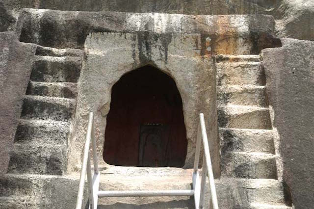
- Rock Cut Caves - You can find this in Jogighopa in the Bongaigaon district. These caves are a fine example of the Salasthambha style of architecture. They are not as elaborate as the rock cut caves in Western India, but they do provide some evidence that this type of architecture did exist in the North Eastern part of India too.
Nature
- Bageshwari Hill - This hill is surrounded by the Birjhora Tea Estate. It provides a panoramic view of the city below. Aside from that, three temples are also located here namely: Bageshwari Temple, Baba Tarak Nath Temple and Shiva Temple, located inside a stone cave.
Central Assam - This consists of Karbi Anglong and North Cachar. This region is between the Lower Assam and North Assam regions. Below it lies the Barak Valley region. Here are some of the must visit places in Central Assam:
1. Tezpur - This is the largest city in Central Assam. It's also known as the Cultural Capital of Assam. The city is also considered as the cleanest one out of all the cities in Assam. Here are some of the attractions you can visit in Tezpur:
Religious
- Mahabhairav Temple - You can find this on a hillock near the town of Tezpur. The original structure was built by King Banasura during the prehistorical era, between the 8th and 10th centuries. The shivalinga in the temple is considered as a living stone that grows a little year by year. The original temple was damaged by the 1897 earthquake. The present structure was built by Sri Swayambar Bharati or Naga Baba.
- Nagsankar Temple - This Shiva temple can be found at the East of Tezpur in Chatia. The origin of the temple is not definite. However, many locals believe that King Nag Sankar from Lohitya dynasty in late 4th century built the temple. Another legend is that King Nagmatta built the temple, he is the son of river god Brahmaputra. In 1480 though, Ahom King Su Sen Pha renovated the temple. Several turtles, fishes, peacocks, deers and pythons can be found around the temple which adds to the mystique of the place.
- Bhairavi Devalaya Temple - This temple is dedicated to the Goddess Bhairavi. She is one of the Mahavidyas of Durga Devi. Legend has it that the daughter of King Banasura, Usha, used to come here to worship the goddess. It is believed that the temple was built around the 5,000 BC.
- Agnigarh - This is a hillock in Tezpur. According to Hindu mythology, this is where Banasura built a fortress to isolate his daughter from other people. However, Usha still fell in love with Aniruddha in her dreams. Her companion, Chitralekha, flew in Aniruddha one night and once the latter opened his eyes, he immediately fell in love with Usha. Aniruddha was Lord Krishna's son and he did agreed with the marriage but Banasura won't. He asked for protection from Lord Shiva which lead to a battle, where rivers of blood flowed, hence the name Tezpur was coined, meaning City of Blood. In the end, an agreement was made to marry the two, through the help of Lord Brahma. This entire story can be seen from the sculptures in the hillock.
- Cole Park - This is also known as Chitralekha Udyan. Chitralekha was the companion of Usha, who brought together the two lovers, the other being Aniruddha. There's a small lake here where paddle boating is allowed. Kids can also enjoy the Bumping Cars attraction here. There's also a model of the jet fighter Valiant MIG 21 and a large concrete mao of India here.
Wildlife
- Bura Chapori Wildlife Sanctuary - This is about 40 kms away from Tezpur. Previously, this was a forest reserve and was only declared a sanctuary in 1995. There are many migratory birds here, with the Bengal florican being the most dominant one. Other animals that you might be able to spot here are the Indian rhinos, leopards, tigers and wild buffalos.
- Nameri National Park - This is about 35 kms from Tezpur. It was established as a sanctuary during the year of 1985. It was then declared a national park during the year of 1998. The park is most well-known for its elephants. You can also spot other animals such as tigers, leopards, Indian wild bisons, leopard cats and clouded leopards here. The park also has over 300 species of birds such as the white-winged wood duck, wreathed hornbill and rufous neck horned bill.
- Da Parbatia - You can find this in the West of Tezpur. It's a small village but the archeological excavations done here are quite extensive. An ancient temple that can be traced back to the 6th century was dug here. This temple was built over another Shiva temple built during the Ahom dynasty. The excavations also revealed many terracotta plaques with humans in sitting position. One of the most important finds here is the door frame made of stone with carvings depicting the Gupta period art form.
- Kolia Bhomora Setu - This is a concrete bridge stretched over Sonitpur to Nagaon. It is about 3,015 metres and was built between the years 1981 to 1987. The bridge was named after Ahom General Kolia Bhomora Phukan.
- District Museum - This museum was established in 1986. It is best known for its wide collection of textiles. You can also find other artefacts like manuscripts, coins, sculptures and inscriptions here.
- Bamuni Hills - You can find this on the right banks of the Brahmaputra River, near the Bhairavi Temple. The site is believed to be the location of an old Vishnu temple along with four smaller temples of Shiva around it. Its construction is believed to have been between the 9th and 10th centuries. The ruins of the temples have floral, geometric and animal designs. It is believed that the temples were built by the Pala dynasty. However, an earthquake might have destroyed it.
- Hazara Pukhuri - This is the third largest water reservoir in Tezpur. The tank was named after Hazara Varman and was excavated during the 19th century. These smaller ponds or lakes within Assam provide some respite from the heat during summer. It's also a great place for strolling around with your loved one.
Nature
- Haflong Lake - This is perhaps the most popular attraction in Haflong. The lake has a hanging bridge which adds beauty to it. Tourists can enjoy angling here as well as there are tons of fishes living in the lake. For the adventure seekers, you can try out some water sports here. There are also boating facilities within the lake itself.
- Panimoor Waterfalls - The source of the Panimoor Waterfalls is the Kopili River. As soon as the river reaches Panimoor, it turns into a thrilling and gushing waterfall. Even Bhupen Hazarika was so enthralled with the beauty of the falls that he wrote a song about it.
- Jatinga Bird Observatory - Jatinga itself is a village in the North Cachar Hills district. It is well-known for the phenomenon of birds committing mass suicide during winter in the village. The mass suicide happens when there are fogs, clouds and mists so between September to November. There's also a set time for it, between 7:00 pm to 10:00 pm. The phenomenon is not yet fully explained although experts believe that the combination of mists and fogs confuse the birds and the lights of the villagers attract them. As they make their way through the lights, they bump into walls, poles and trees which lead to their deaths. You can watch this phenomenon from the observatory centre in Jatinga.
North Assam - This is also known as the Ujoni Oxom Region. It is comprised of the Dhemaji, Dibrugarh, Golaghat, Jorhat, Tinsukia, Lakhimpur and Sibsagar districts. Some of the must-visit places in North Assam are the following:
1. Dibrugarh - This is a city and also the headquarters of the Dibrugarh district of Assam. It is also known as the Tea City of India. The name Dibrugarh means a fort on the banks of the Dibaru River. You can find Dibrugarh on the Easternmost part of Assam. It's one of the fastest growing cities in the state. It is the centre of economic activities in the state with industries like oil and natural gases, tea, power generation, fertiliser and cottage. Here are some of the attractions in Dibrugarh:
Religious
- Tilinga Mandir - This is a Shiva temple in in the Tinsukia district of Assam. Tilinga means bell and mandir means temple, hence the name means Bell Temple. In the temple premises, you can find bells of different sizes and of different materials. It is believed that your wish will be granted in this temple as long as you donate a bell in it. It was in 1965 when a shivalinga emerged near the banyan tree in this location. The tea garden management then built a temple in honour of Shiva and kept the shivalinga within it.
- Barbarua Maidam - This is about 14 kms to the South of Dibrugarh. This maidam houses two graveyards, one of Deka Dihingia Barbarua and the other one to Bura Dihinigia Barbarua. These individuals are officials from the Ahom dynasty.
- Bahikhowa Maidam - This graveyard is dedicated to Bahikhowa Dasarath Dowerah. He was the Chief of the Army of the Ahom dynasty during his lifetime. The graveyard is in ruins now but it's worth a visit for history lovers.
- Sarumechlow and Bormechow Maidam - These graves are dedicated to Sarumechlow and Bormechow, the queens of King Sukhampha Khura. It's one of the few graves dedicated to the royalty in the city.
- Jokai Botanical Garden - This is about 12 kms away from the city centre of Dibrugarh. The botanical garden is a part of the Jokai Forest Reserve. There's a Germplasm Section here showcasing the valuable and endangered plants in the region. Other sections of the garden are the orchids, medicinal plants, aromatic plants and rainforest specimen plants.
2. Majuli - This is a large river island in the Brahmaputra River. In the 20th century, the island had about 1,250 square kilometres of land. However, due to erosion, the island occupies only 325 square kilometres of land now. It is formed by the Brahmaputra River in the South and the Subansiri River in the North. Here are some of the attractions in Majuli:
Satras
- Kamalabari Satra - This was established in 1595 by Badala Ata. Kamala means orange and bari means garden, hence Kamalabri means Orange Garden. The Kalamabari Satra has been a centre of cultural, art, literature and classical studies. Some of the prominent artists that came from the Kamalabari Satra are Maniram Dutta, Muktiyar Bayan and Raseswar Barbayan.
- Dakhinpat Satra - This was established by Satradhikar Sri Vanamalidev in 1584. The satra is a treasure house of dances and antiques of cultural importance. The satra is also the home to about 100 celibate bhakats. The satra also houses important manuscripts written by Srimanta Sankardeva himself.
- Auniati Satra - This satra was established by Ahom King Sultanla in 1653 AD. Its name was derived from Auni Paan, a kind of betel creeper plant found locally in the town and Ati which means elevated place. The presiding deity here is Lord Krishna, which is referred to as Govinda.
1. Silchar - This is the headquarters of the Cachar district of Assam. It is also the second largest city in the state. Back then, the region was known as Shiler Chor, referring to the bank of stones where ships and vessels dock to in here. Over time, Shiler Chor became Silchar. Here are some of the attractions in Silchar:
Religious
- Bhubaneswar Temple - This is a temple dedicated to the Lord Shiva. It's located on top of the Bhuvan Hill, about 50 kms away from Silchar. To reach the temple, one has to trek for about 17 kms as there are no motorable roads that can access it. It is best visited during the Shivaratri when thousands of pilgrims go to the temple to pay their respects.
- Kancha Kanti Kali Temple - This temple is dedicated to the four-armed Goddess Kali and Durga. The temple is about 15 kms from the city centre of Silchar. It is dedicated to Mother Goddess, the union of Goddess Kali and Durga. The idol inside the temple is believed to have been built in 1806.
- Kachari Fort - This is about 20 kms from Silchar. It was constructed around 1690 AD and was the royal seat of the Bodo Kachari dynasty. The main palace in the fort is already in ruins. However, you can still see the main entrance gate, the Devalaya, the Suryadwar and the intricate carvings all over the walls of the fort.
- Martyrs' Tomb - These tombs hold the graves of the 11 martyrs who died fighting for the language movement of Assam during the year 1964. This movement established Bengali as the official language of the Cachar district. These martyrs are the following: Chandicharan Sutradhar, Hitesh Biswas, Satyendra Deb, Kumud Ranjan Das, Sunil Sarkar, Tarani Debnath, Kanailal Niyogi, Sachindra Chandra Pal, Birendra Sutradhar, Sukamal Purakayastha and Kamala Bhattacharya.
- Maniharan Tunnel - You can find this about 5 kms away from the Bhubaneswar Temple. Below the tunnel, the Triveni River flows. You can also find the Maniharan Temple inside the premises of the tunnel. According to mythology, this tunnel was used by Lord Krishna as well.
Lower Assam - You'd have plenty of options for hotels around Guwahati. Outside of it, you'd find a few guest houses and home stays which would have the basic facilities that you need. Here are some hotels in Guwahati:
Budget Hotels in Guwahati
- Hotel Prince B - This hotel is centrally located with easy access to transportation and shopping areas. Their Double Standard Non AC Room is at Rs. 650 per night. It has two twin-sized beds, attached bathroom and bedside table. The hotel also provides laundry and room services for guests. Their address is: Jawaharlal Nehru Stadium, Bhubaneswar Barua Road, Guwahati, Assam 781007.Their contact number is: +91 98766 08800.
- Hotel Tibet - This hotel is very close to the Guwahati Railway Station. They're also just a few minutes away from the bus station. Their Deluxe Room is at Rs. 1,546 per night. It has air-cooling, wardrobe cabinet, flat-screen satellite television and sofa seating area. The bathroom is modern and comes with basic toiletries. The hotel also has a travel desk, business centre, health centre, laundry service and spa. Their address is: AT Road, G.S. Road, Paltan Bazaar, Guwahati, Assam 781008. Their contact number is: +91 97076 22233.
- Hotel Royal Heritage - This hotel is just half a kilometre from the ISBT of Guwahati. It's a three-star hotel with modern amenities as well. Their Deluxe Room is at Rs. 2,000 per night. Rooms have air-conditioning, attached bathroom with hot/cold running water and television. The hotel also has cafe, restaurant, business centre and unisex parlour. Their address is: Betkuchi, NH Opposite Balaji Temple, NH37, Lokhra, Guwahati, Assam 781034. Their contact number is: +91 70860 18001.
- Hotel Gateway Grandeur - This hotel is just four kilometres away from the Guwahati Railway Station. Its location is right at the heart of the city, near the business and commercial centres. Their Grandeur Executive Room is at Rs. 4,800 per night. It has either a king-sized bed or twin-sized beds, bedside table, television and attached bathroom. The hotel has a spa, health centre, swimming pool, restaurants and different halls. Their address is: G.S. Road, Christian Basti, Guwahati, Assam 781005. Their contact number is: +91 361 711 0022.
- Radisson Blu Hotel - This is about 12 kms from the Guwahati Railway Station. The hotel is very near the main attractions of the city though. Their Standard Room is at Rs. 7,499 per night. It has a work desk with a chair, wardrobe cabinet, LED satellite television, WiFi, tea/coffee maker, safe and modern bathroom. The hotel also has a fitness centre, swimming pool, restaurants and bar. Their address is: National Highway 37, Bypass, Gotanagar, Guwahati, Assam 781033. Their contact number is: +91 361 710 0100.
- Vivanta By Taj Guwahati - This hotel is located on the Shillong-Guwahati Highway. It's right at the centre of the cultural hub of the city. Their Superior Charm Room is at Rs. 7,499 per night. You can opt for either a king-sized bed or twin-sized beds. There are amenities like LED television, WiFi, sofa and modern bathroom. The hotel also has different restaurants, a fitness centre and spa. Their address is: Nikita Complex, Khanapara, G.S. Road, Guwahati, Assam 781022. Their contact number is: +91 361 710 6710.
Budget Hotel in Tezpur
- Hotel Pineyard - The Tezpur Railway Station is about a 20-minute drive away from the hotel. Their Pine Paradise Single Room is at Rs. 800 per night. It has an attached bathroom, television and room service. The hotel has a bar/restaurant, transport facilities and laundry services as well. Their address is: Anjana Complex, NB Road, Tezpur, Assam 784001. Their contact number is: +91 3712 222 018.
- Hotel KRC Palace - Their Deluxe Single Room is at Rs. 2,400 per night. It has air-conditioning, television, attached bathroom and tea/coffee maker. The hotel has a spa, salon, business centre, jacuzzi and travel desk. Their address is: JN Road, Kacharigaon, Tezpur, Assam 784001. Their contact number is: +91 3712 222 788.
- Hotel Kalash - Their Super Deluxe Room is at Rs. 2,499 per night. It has an attached bathroom, seating area, television and a choice between king-sized bed or twin-sized beds. Their restaurant also serves vegetarian and non-vegetarian dishes. Their address is: Shree Krishna Rice & Oil Mills N.H. 37A, Mission Chariali, Ketekibari, Tezpur, Assam 784001. Their contact number is: +91 78960 14997.
- The Fern Residency - This is one of the few luxury hotels in Tezpur. Their Winter Green Room is at Rs. 3,800 per night. It comes with amenities like an attached bathroom, television, WiFi, work desk, safe and tea/coffee maker. The hotel also has different restaurants that you can choose from. The hotel also provides laundry services for guests. Their address is: Baruachuburi, Dekargaon, Tezpur, Assam 784501. Their contact number is: +91 3712 255 503.
North Assam - There are many accommodation options in Dibrugarh such as hotels and lodges. However, luxury hotels are quite rare in the city. In Majuli, there are some home stays that you can stay in.
Hotels in Dibrugarh
- Hotel Rajawas - Their Standard Room is at Rs. 999 per night. It has television, attached bathroom with hot/cold running water and direct dialing facility. Their restaurant offers Tandoori cuisine to guests. The hotel also provides laundry services as well as room services for guests. Their address is: A.T. Road, Chotagola, Dibrugarh, Assam 786001. Their contact number is: +91 373 232 3307.
- Dibrugarh Club House - Their Executive Room is at Rs. 1,999 per night. It has air-conditioning, twin sized beds/king-sized bed, bedside table and modern bathroom. The hotel also has a restaurant, bar and games centre. Their address is: A.T. Road, Amolapatty, Opposite Dristi Netralaya, Dibrugarh, 786001. Their contact number is: +91 97060 54107.
- Hotel Tea County - Their Corporate Room is at Rs. 2,499 per night. The room has cable television, modern bathroom and intercom. The hotel has different restaurants, a gymnasium and a banquet hall. Their address is: Convoy Road, Chowkidingee, Dibrugarh, Assam 786001. Their contact number is: +91 75780 10089.
- Eco Camp Me Po Okum - If you'd like to experience living the rural life, then you can consider this eco camp. The cottages and rooms are built in the traditional Meshing style. The home stay also serves local and home cooked meals to guests. Rooms come with a bathroom, bed and mosquito netting. It's very basic but it will do for a short stay. Their address is: Kerelagaon, Garmur, Majuli, Jorhat, Assam, 785104. Their contact number is: +91 99542 13585.
- Prasanti Cottages - This is a government owned tourist lodge. Rentals range between Rs. 1,250 to Rs. 1,600 per night. Rooms have attached bathroom with very basic amenities. Food would be served to you as well, it's part of the tariff. Their address is: Majuli, Jorhat. Their contact number is: 09435734138.
Hotels in Silchar
- Riya Palace Hotel - This is one of the better hotels in Silchar. They don't have a website so their rates aren't published. But expect to pay at least Rs. 1,600 per night or more. Their rooms are decent and relatively clean. Basic amenities like television, bed, bathroom and room service are all included. They also have a restaurant within the hotel premises. Their address is: Park Road, Silchar, India.
- JC International Hotel - The good thing about this hotel is that it is located very near the railway station. However, it's not as well maintained as the Riya Palace Hotel. It's cheaper though so it can be a good option for those in a budget. They also serve quite good tasting meals. Their address is: Circuit House Road, DSA Complex, Silchar 788001.
The cuisine in Assam is called Assamese. Its main features are the following:
- The use of fermentation and drying as forms of preservation.
- The centre of the meal is always rice.
- The use of spices is very little as well as little cooking over fire.
- The flavours of the dishes come from endemic fruits and vegetables in the region.
- The use of fishes, ducks and squabs are popular.
- The traditional meal in Assam comprises of a khar, class of dishes named after the main ingredient and tenga, which is a sour dish.
- Koldil Bhaji - This is banana flower with fried potatoes. The recipe also calls for chilis, garlics, onions, panch foron, salt, turmeric and mustard oil. This dish is best served with rice.
- Amitar Khar - The main ingredients of this dish are papayas and fish heads. This is also best served with rice.
- Bilahi Boror Tenga - This is sour curry with dal pakoda. As mentioned before, tenga is usually served at the end of the meal.
- Komolar Kheer - This dessert has a different taste in a good way. The combination of orange pulps, milk, cashew and almonds make this creamy dessert a definite winner.
- Narikolor Laru - This is a simple dessert, with just fresh coconut garter and sugar as ingredients. They are just mixed together and heated in a pan.


Indus Valley Civilisation
The Indus Valley Civilisation (IVC), also known as the Sindhu Sarasvati
Civilisation or Harappan Civilisation,[1] was a Bronze Age civilisation (3300–
1300 BCE; mature period 2600–1900 BCE) mainly in the northwestern regions of
South Asia, extending from what today is northeast Afghanistan to Pakistan and
northwest India.[2] Along with Ancient Egypt and Mesopotamia, it was one of three
early cradles of civilisations of the Old World, and of the three, the most
widespread.[3][note 1]
Aridification of this region during the 3rd millennium BCE may have been the initial
spur for the urbanisation associated with the civilisation, but eventually also reduced
the water supply enough to cause the civilisation's demise, and to scatter its
population eastward.[4][5][6][7][note 2]
At its peak, the Indus Civilisation may have had a population of over five million.[8]
Inhabitants of the ancient Indus River valley developed new techniques in handicraft
(carnelian products, seal carving) and metallurgy (copper, bronze, lead, and tin). The
Indus cities are noted for their urban planning, baked brick houses, elaborate
drainage systems, water supply systems, and clusters of large non-residential
buildings.[9] Children's toys were found in the cities, with few weapons of war,
suggesting peace and prosperity.[10] Their trade seals, decorated with animals
and mythical beings, indicate they conducted thriving trade with lands as far
away as Sumer in southern Mesopotamia.[10]
The Indus Valley Civilisation is also named the Harappan civilisation after
Harappa, the first of its sites to be excavated in the 1920s, in what was then the
Punjab province of British India.[11] The discovery of Harappa, and soon
afterwards Mohenjo-daro, was the culmination of work beginning in 1861 with
the founding of the Archaeological Survey of India in the British Raj.[12]
Excavation of Harappan sites has been ongoing since 1920, with important
breakthroughs occurring as recently as 1999.[13] This Harappan civilisation is
sometimes called the Mature Harappan culture to distinguish it from the
cultures immediately preceding and following it. Of these, the earlier is often
called the Early Harappan culture, while the later one may be referred to as the Late Harappan, both of which existed in the same area
as the Mature Harappan Civilisation. The early Harappan cultures were preceded by local Neolithic agricultural villages, from which
the river plains were populated.[14][15] A total of 1,022 cities and settlements had been found by 2008,[1] mainly in the general region
of the Indus and Ghaggar-Hakra Rivers, and their tributaries; of which 406 sites are in Pakistan and 616 sites in India;[1] of these 96
have been excavated.[1] Among the settlements were the major urban centres of Harappa, Mohenjo-daro (UNESCO World Heritage
Site), Dholavira, Ganeriwala and Rakhigarhi.[16]
The Harappan language is not directly attested, and its affiliation is uncertain since the Indus script is still undeciphered. A
relationship with the Dravidian or Elamo-Dravidian language family is favoured by a section of scholars[1. 7][18]
Name
Excavated ruins of Mohenjo-daro, Sindh
province, Pakistan, showing the Great
Bath in the foreground. Mohenjo-daro,
on the right bank of the Indus River, is a
UNESCO World Heritage Site, the first
site in South Asia to be so declared.
Contents
Extent
Discovery and history of excavation
Chronology
Pre-Harappan - Mehrgarh
Early Harappan
Mature Harappan
Cities
Authority and governance
Technology
Arts and crafts
Trade and transportation
Agriculture
Language
Possible writing system
Religion
Late Harappan
"Aryan invasion"
Climate change and drought
Continuity
Post-Harappan
Historical context
Near East
Dasyu
Munda
See also
Notes
Citations
Bibliography
Further reading
External links
The Indus Valley Civilisation is named after the Indus Valley, where the first remains were found. The Indus Valley Civilisation is
also named the Harappan civilisation after Harappa, the first of its sites to be excavated in the 1920s, in what was then the Punjab
province of British India.[19]
The Indus Valley Civilisation has also been called by some the "Sarasvati culture", the "Sarasvati Civilisation", the "Indus-Sarasvati
Civilisation" or the "Sindhu-Saraswati Civilisation", as theG haggar-Hakra river is identified by some with the mythologicalS arasvati
river,[1][20][21] suggesting that the Indus Valley Civilisation was the Vedic civilisation as perceived by traditional Hindu
beliefs.[22][23][24][note 3]
The Indus Valley Civilisation (IVC) encompassed much of Pakistan, western India, and northeastern Afghanistan; extending from
Pakistani Balochistan in the west to Uttar Pradesh in the east, northeastern Afghanistan in the north and Maharashtra in the south.[27]
Shortugai to the north is on the Oxus River, the Afghan border with Tajikistan, and in the west Sutkagan Dor is close to the Iranian
border. The Kulli culture of Balochistan, of which more than 100 settlement sites are known, can be regarded as a local variant of the
IVC, or a related culture.
Name
Extent
The geography of the Indus Valley put the civilisations that arose there in a highly
similar situation to those in Egypt and Peru, with rich agricultural lands being
surrounded by highlands, desert, and ocean. Recently, Indus sites have been
discovered in Pakistan's Khyber Pakhtunkhwa as well. Other IVC colonies can be
found in Afghanistan while smaller isolated colonies can be found as far away as
Turkmenistan and in Maharashtra. The largest number of colonies are in the Punjab,
Sindh, Rajasthan, Haryana, and Gujarat belt Coastal settlements extended from
Sutkagan Dor[28] in Western Baluchistan to Lothal[29] in Gujarat. An Indus Valley
site has been found on the Oxus River at Shortughai in northern Afghanistan,[30] in
the Gomal River valley in northwestern Pakistan,[31] at Manda, Jammu on the Beas
River near Jammu,[32] India, and at Alamgirpur on the Hindon River, only 28 km
from Delhi.[33] Indus Valley sites have been found most often on rivers, but also on
the ancient seacoast,[34] for example, Balakot,[35] and on islands, for example,
Dholavira.[36]
It flourished along a system of monsoon-fed perennial rivers in the basins of the
Ghaggar-Hakra River in northwest India, and the Indus River flowing through the
length of Pakistan.[37][38][6][note 4] There is evidence of dry river beds overlapping with
the Ghaggar River in India and Hakra channel in Pakistan.
616 sites have been discovered along the dried up river beds of the Ghaggar-Hakra
River and its tributaries,[1] while 406 sites have been found along the Indus and its
tributaries.[1] According to Shereen Ratnagar the Ghaggar-Hakra desert area has more
remaining sites than the alluvium of the Indus Valley, since the Ghaggar-Hakra desert
area has been left untouched by settlements and agriculture since the end of the Indus
Valley Civilisation.[39]
The ruins of Harappa were described in 1842 by Charles Masson in his Narrative of
Various Journeys in Balochistan, Afghanistan, and the Punjab, where locals talked of an
ancient city extending "thirteen cosses" (about 25 miles or 41 km).[note 5]
In 1856, Alexander Cunningham, later director-general of the archaeological survey of
northern India, visited Harappa where the British engineers John and William Brunton
were laying the East Indian Railway Company line connecting the cities of Karachi and
Lahore. John wrote, "I was much exercised in my mind how we were to get ballast for the line of the railway". They were told of an
ancient ruined city near the lines, called Harappa. Visiting the city, he found it full of hard well-burnt bricks, and, "convinced that
there was a grand quarry for the ballast I wanted", the city of Harappa was reduced to ballast.[41] A few months later, further north,
John's brother William Brunton's "section of the line ran near another ruined city, bricks from which had already been used by
villagers in the nearby village of Harappa at the same site. These bricks now provided ballast along 93 miles (150 km) of the railroad
track running from Karachi to Lahore"[.41]
In 1872–75, Cunningham published the first Harappan seal (with an erroneous identification as Brahmi letters).[42] More Harappan
seals were discovered in 1912 by John Faithfull Fleet, prompting an archaeological campaign under Sir John Hubert Marshall.
Marshall, Rai Bahadur Daya Ram Sahni and Madho Sarup Vats began excavating Harappa in 1921, finding buildings and artefacts
indicative of an ancient civilisation. These were soon complemented by discoveries at Mohenjo-daro by Rakhal Das Banerjee, Ernest
J. H. Mackay, and Marshall. By 1931, much of Mohenjo-daro had been excavated, but excavations continued, such as that led by Sir
Mortimer Wheeler, director of the Archaeological Survey of India in 1944. Among other archaeologists who worked on IVC sites
before the independence in 1947 wereA hmad Hasan Dani, Brij Basi Lal, Nani Gopal Majumdar, and Sir Marc Aurel Stein.[43]
Locations of IVC-sites
Diorama reconstruction of
everyday life in Indus Valley
Civilisation (National Science
Centre, Delhi, India)
Discovery and history of excavation
Following independence, the bulk of the archaeological finds were inherited by
Pakistan where most of the IVC was based, with new discoveries India now has 50%
more sites than Pakistan. Outposts of the Indus Valley civilisation were excavated as
far west as Sutkagan Dor in Pakistani Balochistan, as far north as at Shortugai on the
Amu Darya (the river's ancient name was Oxus) in current Afghanistan, as far east
as at Alamgirpur, Uttar Pradesh, India and as far south as at Malwan, in modern-day
Surat, Gujarat, India.[1]
In 2010, heavy floods hit Haryana in India and damaged the archaeological site of
Jognakhera, where ancient copper smelting furnaces were found dating back almost
5,000 years. The Indus Valley Civilisation site was hit by almost 10 feet of water as
the Sutlej Yamuna link canal overflowed.[44]
The cities of the Indus Valley Civilisation had "social hierarchies, their writing
system, their large planned cities and their long-distance trade [which] mark them to
archaeologists as a full-fledged 'civilisation.'"[45] The mature phase of the Harappan
civilisation lasted from c. 2600 to 1900 BCE. With the inclusion of the predecessor
and successor cultures — Early Harappan and Late Harappan, respectively — the
entire Indus Valley Civilisation may be taken to have lasted from the 33rd to the
14th centuries BCE. It is part of the Indus Valley Tradition, which also includes the
pre-Harappan occupation of Mehrgarh, the earliest farming site of the Indus
Valley.[15][46]
Several periodisations are employed for the periodisation of the IVC.[15][46] The
most commonly used classifies the Indus Valley Civilisation into Early, Mature and
Late Harappan Phase.[47] An alternative approach by Shaffer divides the broader
Indus Valley Tradition into four eras, the pre-Harappan "Early Food Producing Era,"
and the Regionalisation, Integration, and Localisation eras, which correspond
roughly with the Early Harappan, Mature Harappan, and Late Harappan phase[s1.4][48]
According to Rao, Hakra Ware has been found at Bhirrana, and is pre-Harappan, dating to the 8th-7th millennium BCE.[49][50][51]
Hakra Ware culture is a material culture which is contemporaneous with the early Harappan Ravi phase culture (3300-2800 BCE) of
the Indus Valley.[52][53] According to Dikshit and Rami, the estimation for the antiquity of Bhirrana as pre-Harappan is based on two
calculations of charcoal samples, giving two dates of respectively 7570-7180 BCE, and 6689-6201 BC[E49.][50]
Indus Valley pottery, 2500–1900 BCE
Archaeological ruins at Mohenjodaro,
Sindh, Pakistan
Chronology
Dates Main Phase Mehrgarh
phases
Harappan
phases Other phases Era
7000–
5500
BCE
Pre-Harappan
Mehrgarh
I
(aceramic
Neolithic)
Early Food
Producing Era
5500–
3300
BCE
Pre-Harappan/Early
Harappan[54]
Mehrgarh
II-VI
(ceramic
Neolithic)
Regionalisation Era
c.4000-2500/2300 BCE
(Shaffer)[55]
c.5000-3200 BCE
(Coningham & Young)[56]
3300–
2800
BCE
Early Harappan[54]
c.3300-2800 BCE
(Mughal)[57][54][58]
c.5000-2800 BCE
(Kenoyer)[54]
Harappan 1
(Ravi
Phase;
Hakra
Ware)
2800–
2600
BCE
Mehrgarh
VII
Harappan 2
(Kot Diji
Phase,
Nausharo I)
2600–
2450
BCE
Mature Harappan
(Indus Valley
Civilisation)
Harappan
3A
(Nausharo
II)
2450– Integration Era
2200
BCE
Harappan
3B
2200–
1900
BCE
Harappan
3C
1900–
1700
BCE
Late Harappan
Harappan 4
Cemetery H[59]
Ochre Coloured Pottery[59] Localisation Era
1700–
1300
BCE
Harappan 5
1300–
600
BCE
Post-Harappan
Iron Age India
Painted Grey Ware (1200-
600 BCE)
Vedic period (c.1500-500
BCE)
Regionalisation
c.1200-300 BCE
(Kenoyer)[54]
c.1500[60]-600 BCE
(Coningham &
Young)[61]
600-
300
BCE
Northern Black Polished
Ware (Iron Age)(700-200
BCE)
Second urbanisation
(c.500-200 BCE)
Integration[61]
Mehrgarh is a Neolithic (7000 BCE to c. 2500 BCE) site to the west of the Indus River valley, near the capital of the Kachi District in
Pakistan, on the Kacchi Plain of Balochistan, near the Bolan Pass.[63] According to Ahmad Hasan Dani, professor emeritus at Quaide-
Azam University, Islamabad, the discovery of Mehrgarh "changed the entire concept of the Indus civilisation […] There we have
the whole sequence, right from the beginning of settled village life[.4"5] Mehrgarh is one of the earliest sites with evidence of farming
and herding in South Asia.[64][65][note 7] According to Parpola, the culture migrated into the Indus Valley and became the Indus
Valley Civilisation.[75]
Pre-Harappan - Mehrgarh
Mehrgarh was influenced by the Near Eastern Neolithic,[76] with similarities
between "domesticated wheat varieties, early phases of farming, pottery, other
archaeological artefacts, some domesticated plants and herd animals."[77] Gallego
Romero et al. (2011) notice that "[t]he earliest evidence of cattle herding in south
Asia comes from the Indus River Valley site of Mehrgarh and is dated to 7,000
YBP."[78][note 8]
Lukacs and Hemphill suggest an initial local development of Mehrgarh, with a
continuity in cultural development but a change in population. According to Lukacs
and Hemphill, while there is a strong continuity between the neolithic and
chalcolithic (Copper Age) cultures of Mehrgarh, dental evidence shows that the
chalcolithic population did not descend from the neolithic population of
Mehrgarh,[80] which "suggests moderate levels of gene flow."[80][note 9]
Masacernhas et al. (2015) note that "new, possibly West Asian, body types are
reported from the graves of Mehrgarh beginning in the Togau phase (3800
BCE)."[81]
The Early Harappan Ravi Phase, named after the nearby Ravi River, lasted from
c. 3300 BCE until 2800 BCE. It is related to the Hakra Phase, identified in the
Ghaggar-Hakra River Valley to the west, and predates the Kot Diji Phase (2800–
2600 BCE, Harappan 2), named after a site in northern Sindh, Pakistan, near
Mohenjo-daro. The earliest examples of the Indus script date to the 3rd millennium
BCE.[82][83]
The mature phase of earlier village cultures is represented by Rehman Dheri and
Amri in Pakistan.[84] Kot Diji represents the phase leading up to Mature Harappan,
with the citadel representing centralised authority and an increasingly urban quality
of life. Another town of this stage was found at Kalibangan in India on the Hakra
River.[85]
Trade networks linked this culture with related regional cultures and distant sources of raw materials, including lapis lazuli and other
materials for bead-making. By this time, villagers had domesticated numerous crops, including peas, sesame seeds, dates, and cotton,
as well as animals, including the water buffalo. Early Harappan communities turned to large urban centres by 2600 BCE, from where
the mature Harappan phase started. The latest research shows that Indus aVlley people migrated from villages to cities[.86][87]
The final stages of the Early Harappan period are characterised by the building of large walled settlements, the expansion of trade
networks, and the increasing integration of regional communities into a "relatively uniform" material culture in terms of pottery
styles, ornaments, and stamp seals with Indus script, leading into the transition to the Mature Harappan phase[8.8]
According to Giosan et al. (2012), the slow southward migration of the monsoons across Asia initially allowed the Indus Valley
villages to develop by taming the floods of the Indus and its tributaries. Flood-supported farming led to large agricultural surpluses,
which in turn supported the development of cities. The IVC residents did not develop irrigation capabilities, relying mainly on the
seasonal monsoons leading to summer floods.[6] Brooke further notes that the development of advanced cities coincides with a
reduction in rainfall, which may have triggered a reogranisation into larger urban centers.[7][note 2]
According to J. G. Shaffer and D. A. Lichtenstein,[89] the Mature Harappan Civilisation was "a fusion of the Bagor, Hakra, and Kot
Diji traditions or 'ethnic groups' in the Ghagga-rHakra valley on the borders of India and Pakistan"[9. 0]
Haplogroup L-M20 has a high
frequency in the Indus Valley.
McElreavy & Quintana-Murci (2005)
note that "both the frequency
distribution and estimated expansion
time (~7,000 YBP) of this lineage
suggest that its spread in the Indus
Valley may be associated with the
expansion of local farming groups
during the Neolithic period."[62][note 6]
Early Harappan
Early Harappan Period, c. 3300–
2600 BCE
Mature Harappan
By 2600 BCE, the Early Harappan communities turned into large urban centres.
Such urban centres include Harappa, Ganeriwala, Mohenjo-daro in modern-day
Pakistan, and Dholavira, Kalibangan, Rakhigarhi, Rupar, and Lothal in modern-day
India.[91] In total, more than 1,052 cities and settlements have been found, mainly in
the general region of the Indus Rivers and their tributaries.
A sophisticated and technologically advanced urban culture is evident in the Indus
Valley Civilisation making them the first urban centre in the region. The quality of
municipal town planning suggests the knowledge of urban planning and efficient
municipal governments which placed a high priority on hygiene, or, alternatively,
accessibility to the means of religious ritual.
As seen in Harappa, Mohenjo-daro and the recently partially excavated Rakhigarhi,
this urban plan included the world's first known urban sanitation systems: see
hydraulic engineering of the Indus Valley Civilisation. Within the city, individual
homes or groups of homes obtained water from wells. From a room that appears to
have been set aside for bathing, waste water was directed to covered drains, which
lined the major streets. Houses opened only to inner courtyards and smaller lanes.
The house-building in some villages in the region still resembles in some respects
the house-building of the Harappans[.92]
The ancient Indus systems of sewerage and drainage that were developed and used
in cities throughout the Indus region were far more advanced than any found in
contemporary urban sites in the Middle East and even more efficient than those in
many areas of Pakistan and India today. The advanced architecture of the Harappans
is shown by their impressive dockyards, granaries, warehouses, brick platforms, and
protective walls. The massive walls of Indus cities most likely protected the
Harappans from floods and may have dissuaded military conflict[s9.3]
The purpose of the citadel remains debated. In sharp contrast to this civilisation's
contemporaries, Mesopotamia and ancient Egypt, no large monumental structures
were built. There is no conclusive evidence of palaces or temples—or of kings,
armies, or priests. Some structures are thought to have been granaries. Found at one
city is an enormous well-built bath (the "Great Bath"), which may have been a
public bath. Although the citadels were walled, it is far from clear that these
structures were defensive. They may have been built to divert flood waters.
Most city dwellers appear to have been traders or artisans, who lived with others
pursuing the same occupation in well-defined neighbourhoods. Materials from
distant regions were used in the cities for constructing seals, beads and other objects.
Among the artefacts discovered were beautiful glazed faïence beads. Steatite seals
have images of animals, people (perhaps gods), and other types of inscriptions,
including the yet un-deciphered writing system of the Indus Valley Civilisation.
Some of the seals were used to stamp clay on trade goods and most probably had
other uses as well.
Although some houses were larger than others, Indus Civilisation cities were remarkable for their apparent, if relative, egalitarianism.
All the houses had access to water and drainage facilities. This gives the impression of a society with relatively low wealth
concentration, though clear social levelling is seen in personal adornments.
Mature Harappan Period, c. 2600–
1900 BCE
Mohenjo-daro
View of Granary and Great Hall on
Mound F in Harappa
Cities
Computer-aided reconstruction of
coastal Harappan settlement at
Sokhta Koh near Pasni, Pakistan
Toilets that used water were used in the Indus Valley Civilisation. The cities of
Harappa and Mohenjo-daro had a flush toilet in almost every house, attached to a
sophisticated sewage system.[94]
Archaeological records provide no immediate answers for a centre of power or for
depictions of people in power in Harappan society. But, there are indications of
complex decisions being taken and implemented. For instance, the majority of the
cities were constructed in a highly uniform and well-planned grid pattern, suggesting
they were planned by a central authority; extraordinary uniformity of Harappan
artefacts as evident in pottery, seals, weights and bricks; presence of public facilities
and monumental architecture; heterogeneity in the mortuary symbolism and in grave
goods (items included in burials).
These are the major theories:
There was a single state, given the similarity in artefacts, the evidence
for planned settlements, the standardised ratio of brick size, and the
establishment of settlements near sources of raw material.
There was no single ruler but several cities like Mohenjo-daro had a
separate ruler, Harappa another, and so forth.
Harappan society had no rulers, and everybody enjoyed equal status
and hence some type of Democracy.
The people of the Indus Civilisation achieved great accuracy in measuring length,
mass, and time. They were among the first to develop a system of uniform weights
and measures. A comparison of available objects indicates large scale variation
across the Indus territories. Their smallest division, which is marked on an ivory
scale found in Lothal in Gujarat, was approximately 1.704 mm, the smallest division
ever recorded on a scale of the Bronze Age. Harappan engineers followed the
decimal division of measurement for all practical purposes, including the
measurement of mass as revealed by theirh exahedron weights.[95]
These chert weights were in a ratio of 5:2:1 with weights of 0.05, 0.1, 0.2, 0.5, 1, 2,
5, 10, 20, 50, 100, 200, and 500 units, with each unit weighing approximately
28 grams, similar to the English Imperial ounce or Greek uncia, and smaller objects
were weighed in similar ratios with the units of 0.871. However, as in other cultures,
actual weights were not uniform throughout the area. The weights and measures
later used in Kautilya's Arthashastra (4th century BCE) are the same as those used
in Lothal.[96]
Harappans evolved some new techniques in metallurgy and produced copper,
bronze, lead, and tin. The engineering skill of the Harappans was remarkable, especially in building dock[s9.7]
In 2001, archaeologists studying the remains of two men from Mehrgarh, Pakistan, discovered that the people of the Indus Valley
Civilisation, from the early Harappan periods, had knowledge of proto-dentistry. Later, in April 2006, it was announced in the
scientific journal Nature that the oldest (and first early Neolithic) evidence for the drilling of human teeth in vivo (i.e., in a living
person) was found in Mehrgarh. Eleven drilled molar crowns from nine adults were discovered in a Neolithic graveyard in Mehrgarh
that dates from 7,500–9,000 years ago. According to the authors, their discoveries point to a tradition of proto-dentistry in the early
farming cultures of that region.[98]
So-called "Priest King" statue,
Mohenjo-daro, late Mature Harappan
period, National Museum, Karachi,
Pakistan
Dholavira Sophisticated Water
Reservoir, evidence for hydraulic
sewage systems in the ancient Indus
Valley Civilisation
Authority and governance
Technology
Unicorn seal of Indus Valley, Indian
Museum
A touchstone bearing gold streaks was found in Banawali, which was probably used
for testing the purity of gold (such a technique is still used in some parts of
India).[90]
Various sculptures, seals, bronze vessels pottery, gold jewellery, and anatomically
detailed figurines in terracotta, bronze, and steatite have been found at excavation
sites.[99]
A number of gold, terracotta and stone figurines of girls in dancing poses reveal the
presence of some dance form. These terracotta figurines included cows, bears,
monkeys, and dogs. The animal depicted on a majority of seals at sites of the mature
period has not been clearly identified. Part bull, part zebra, with a majestic horn, it
has been a source of speculation. As yet, there is insufficient evidence to substantiate
claims that the image had religious or cultic significance, but the prevalence of the
image raises the question of whether or not the animals in images of the IVC are
religious symbols.[100]
Sir John Marshall reacted with surprise when he saw the famous Indus bronze
statuette of a slender-limbed dancing girl in Mohenjo-daro:
"When I first saw them I found it difficult to believe that they were
prehistoric; they seemed to completely upset all established ideas about early
art, and culture. Modeling such as this was unknown in the ancient world up to
the Hellenistic age of Greece, and I thought, therefore, that some mistake must
surely have been made; that these figures had found their way into levels some
3000 years older than those to which they properly belonged .... Now, in these
statuettes, it is just this anatomical truth which is so startling; that makes us
wonder whether, in this all-important matter, Greek artistry could possibly
have been anticipated by the sculptors of a far-off age on the banks of the
Indus".[101]
Many crafts including, "shell working, ceramics, and agate and glazed steatite bead making"
were practised and the pieces were used in the making of necklaces, bangles, and other
ornaments from all phases of Harappan culture. Some of these crafts are still practised in the
subcontinent today.[102] Some make-up and toiletry items (a special kind of combs (kakai),
the use of collyrium and a special three-in-one toiletry gadget) that were found in Harappan
contexts still have similar counterparts in modern India.[103] Terracotta female figurines were
found (ca. 2800–2600 BCE) which had red colour applied to the "manga" (line of partition of the hai[r1)0.3]
Seals have been found at Mohenjo-daro depicting a figure standing on its head, and another sitting cross-legged in what some call a
yoga-like pose (see image, the so-called Pashupati, below). This figure, sometimes known as a Pashupati, has been variously
identified. Sir John Marshall identified a resemblance to the Hindu god, Shiva.[104] If this can be validated, it would be evidence that
some aspects of Hinduism predate the earliest texts, the Veda.
A harp-like instrument depicted on an Indus seal and two shell objects found at Lothal indicate the use of stringed musical
instruments. The Harappans also made various toys and games, among them cubical dice (with one to six holes on the faces), which
were found in sites like Mohenjo-Daro[.105]
Elephant seal of Indus Valley, Indian
Museum
Indus Valley seals, British Museum
Arts and crafts
The "dancing girl of
Mohenjo-daro" (replica)
The Indus civilisation's economy appears to have depended significantly on trade,
which was facilitated by major advances in transport technology. The IVC may have
been the first civilisation to use wheeled transport.[106] These advances may have
included bullock carts that are identical to those seen throughout South Asia today,
as well as boats. Most of these boats were probably small, flat-bottomed craft,
perhaps driven by sail, similar to those one can see on the Indus River today;
however, there is secondary evidence of sea-going craft. Archaeologists have
discovered a massive, dredged canal and what they regard as a docking facility at the
coastal city of Lothal in western India (Gujarat state). An extensive canal network,
used for irrigation, has however also been discovered by H.-.P Francfort.[107]
During 4300–3200 BCE of the chalcolithic period (copper age), the Indus Valley
Civilisation area shows ceramic similarities with southern Turkmenistan and
northern Iran which suggest considerable mobility and trade. During the Early
Harappan period (about 3200–2600 BCE), similarities in pottery, seals, figurines,
ornaments, etc. document intensive caravan trade with Central Asia and the Iranian
plateau.[108]
Judging from the dispersal of Indus civilisation artefacts, the
trade networks, economically, integrated a huge area, including
portions of Afghanistan, the coastal regions of Persia, northern
and western India, and Mesopotamia. Studies of tooth enamel
from individuals buried at Harappa suggest that some residents
had migrated to the city from beyond the Indus Valley.[109]
There is some evidence that trade contacts extended toC rete and
possibly to Egypt.[110]
There was an extensive maritime trade network operating
between the Harappan and Mesopotamian civilisations as early
as the middle Harappan Phase, with much commerce being
handled by "middlemen merchants from Dilmun" (modern
Bahrain and Failaka located in the Persian Gulf).[111] Such
long-distance sea trade became feasible with the development of plank-built watercraft, equipped with a single central mast
supporting a sail of woven rushes or cloth[.112]
Several coastal settlements like Sotkagen-dor (astride Dasht River, north of Jiwani), Sokhta Koh (astride Shadi River, north of Pasni),
and Balakot (near Sonmiani) in Pakistan along with Lothal in western India, testify to their role as Harappan trading outposts.
Shallow harbours located at the estuaries of rivers opening into the sea allowed brisk maritime trade with Mesopotamian cities.
"It is generally assumed that most trade between the Indus Valley (ancient Meluhha?) and western neighbors
proceeded up the Persian Gulf rather than overland. Although there is no incontrovertible proof that this was indeed
the case, the distribution of Indus-type artifacts on the Oman peninsula, on Bahrain and in southern Mesopotamia
makes it plausible that a series of maritime stages linked the Indus Valley and the Gulf region."[113]
In the 1980s, important archaeological discoveries were made at Ras al-Jinz (Oman), demonstrating maritime Indus Valley
connections with the Arabian Peninsula.[112][114][115]
Chanhudaro. Fragment of Large
Deep Vessel, circa 2500 BCE. Red
pottery with red and black slippainted
decoration, 415/16×6⅛ in.
(12.5×15.5 cm). Brooklyn Museum
Trade and transportation
The docks of ancient Lothal as they are today (2006)
Agriculture
According to Gangal et al. (2014), there is strong archeological and geographical evidence that neolithic farming spread from the
Near East into north-west India, but there is also "good evidence for the local domestication of barley and the zebu cattle at
Mehrgarh."[76][note 10]
According to Jean-Francois Jarrige, farming had an independent origin at Mehrgarh, despite the similarities which he notes between
Neolithic sites from eastern Mesopotamia and the western Indus valley, which are evidence of a "cultural continuum" between those
sites. Nevertheless, Jarrige concludes that Mehrgarh has an earlier local background," and is not a "'backwater' of the Neolithic
culture of the Near East."[116] Archaeologist Jim G. Shaffer writes that the Mehrgarh site "demonstrates that food production was an
indigenous South Asian phenomenon" and that the data support interpretation of "the prehistoric urbanisation and complex social
organisation in South Asia as based on indigenous, but not isolated, cultural developments"[.117]
Jarrige notes that the people of Mehrgarh used domesticated wheats and barley,[118] while Shaffer and Liechtenstein note that the
major cultivated cereal crop was naked six-row barley, a crop derived from two-row barley.[119] Gangal agrees that "Neolithic
domesticated crops in Mehrgarh include more than 90% barley," noting that "there is good evidence for the local domestication of
barley." Yet, Gangal also notes that the crop also included "a small amount of wheat," which "are suggested to be of Near-Eastern
origin, as the modern distribution of wild varieties of wheat is limited to Northern Levant and Southernu Trkey.[76][note 11]"
The cattle that is often portrayed on Indus seals are humped Indian aurochs, that is
similar to Zebu cattle. Zebu cattle is still common in India, and in Africa. It is
different from the European cattle, and had been originally domesticated on the
Indian subcontinent, probably in theB aluchistan region of Pakistan.[120][76][note 10]
It has often been suggested that the bearers of the IVC corresponded to proto-
Dravidians linguistically, the break-up of proto-Dravidian corresponding to the
break-up of the Late Harappan culture.[121] Finnish Indologist Asko Parpola
concludes that the uniformity of the Indus inscriptions precludes any possibility of
widely different languages being used, and that an early form of Dravidian language
must have been the language of the Indus people.[122] Today, the Dravidian
language family is concentrated mostly in southern India and northern and eastern
Sri Lanka, but pockets of it still remain throughout the rest of India and Pakistan (the
Brahui language), which lends credence to the theory.
According to Heggarty and Renfrew, Dravidian languages may have spread into the
Indian subcontinent with the spread of farming.[123] According to David McAlpin,
the Dravidian languages were brought to India by immigration into India from
Elam.[note 12] In earlier publications, Renfrew also stated that proto-Dravidian was
brought to India by farmers from the Iranian part of the Fertile
Crescent,[124][125][126][note 13] but more recently Heggarty and Renfrew note that
"a great deal remains to be done in elucidating the prehistory of Dravidian." They
also note that "McAlpin's analysis of the language data, and thus his claims, remain
far from orthodoxy."[123] Heggarty and Renfrew conclude that several scenarios are compatible with the data, and that "the linguistic
jury is still very much out."[123][note 15]
Between 400 and as many as 600 distinct Indus symbols[131] have been found on seals, small tablets, ceramic pots and more than a
dozen other materials, including a "signboard" that apparently once hung over the gate of the inner citadel of the Indus city of
Dholavira.
Zebu cattle in Pune, India
Indus Valley seals with a Zebu Bull,
Elephant, and Rhinoceros, 2500–
1900 BCE
Language
Possible writing system
Typical Indus inscriptions are no more than four or five characters in length, most of
which (aside from the Dholavira "signboard") are tiny; the longest on a single surface,
which is less than 1 inch (2.54 cm) square, is 17 signs long; the longest on any object
(found on three different faces of a mass-produced object) has a length of 26 symbols.
While the Indus Valley Civilisation is generally characterised as a literate society on the
evidence of these inscriptions, this description has been challenged by Farmer, Sproat,
and Witzel (2004)[132] who argue that the Indus system did not encode language, but
was instead similar to a variety of non-linguistic sign systems used extensively in the Near East and other societies, to symbolise
families, clans, gods, and religious concepts. Others have claimed on occasion that the symbols were exclusively used for economic
transactions, but this claim leaves unexplained the appearance of Indus symbols on many ritual objects, many of which were massproduced
in moulds. No parallels to these mass-produced inscriptions are known in any other early ancient civilisation[1s3. 3]
In a 2009 study by P. N. Rao et al. published in Science, computer scientists, comparing the pattern of symbols to various linguistic
scripts and non-linguistic systems, including DNA and a computer programming language, found that the Indus script's pattern is
closer to that of spoken words, supporting the hypothesis that it codes for an as-yet-unknown languag[1e3.4][135]
Farmer, Sproat, and Witzel have disputed this finding, pointing out that Rao et al. did not actually compare the Indus signs with "realworld
non-linguistic systems" but rather with "two wholly artificial systems invented by the authors, one consisting of 200,000
randomly ordered signs and another of 200,000 fully ordered signs, that they spuriously claim represent the structures of all realworld
non-linguistic sign systems".[136] Farmer et al. have also demonstrated that a comparison of a non-linguistic system like
medieval heraldic signs with natural languages yields results similar to those that Rao et al. obtained with Indus signs. They conclude
that the method used by Rao et al. cannot distinguish linguistic systems from non-linguistic one[1s3. 7]
The messages on the seals have proved to be too short to be decoded by a computer. Each seal has a distinctive combination of
symbols and there are too few examples of each sequence to provide a sufficient context. The symbols that accompany the images
vary from seal to seal, making it impossible to derive a meaning for the symbols from the images. There have, nonetheless, been a
number of interpretations offered for the meaning of the seals. These interpretations have been marked by ambiguity and
subjectivity.[137]:69
Photos of many of the thousands of extant inscriptions are published in the Corpus of Indus Seals and Inscriptions (1987, 1991,
2010), edited by Asko Parpola and his colleagues. The final, third, volume, republished photos taken in the 1920s and 1930s of
hundreds of lost or stolen inscriptions, along with many discovered in the last few decades. Formerly, researchers had to supplement
the materials in the Corpus by study of the tiny photos in the excavation reports of Marshall (1931), MacKay (1938, 1943), Wheeler
(1947), or reproductions in more recent scattered sources.
Edakkal caves in Wayanad district of Kerala contain drawings that range over periods from as early as 5000 BCE to 1000 BCE. The
youngest group of paintings have been in the news for a possible connection to the Indusa Vlley Civilisation.
The religion and belief system of the Indus Valley people have received considerable attention, especially from the view of
identifying precursors to deities and religious practices of Indian religions that later developed in the area. However, due to the
sparsity of evidence, which is open to varying interpretations, and the fact that the Indus script remains undeciphered, the conclusions
are partly speculative and largely based on a retrospective view from a much later Hindu perspective.[138][139] An early and
influential work in the area that set the trend for Hindu interpretations of archaeological evidence from the Harappan sites[140] was
that of John Marshall, who in 1931 identified the following as prominent features of the Indus religion: a Great Male God and a
Mother Goddess; deification or veneration of animals and plants; symbolic representation of the phallulsi n(ga) and vulva (yoni); and,
use of baths and water in religious practice. Marshall's interpretations have been much debated, and sometimes disputed over the
following decades.[141][142]
Ten Indus Signs, dubbed the
Dholavira Signboard
Religion
One Indus Valley seal shows a seated figure with a horned headdress, possibly
tricephalic and possibly ithyphallic, surrounded by animals. Marshall identified the
figure as an early form of the Hindu god Shiva (or Rudra), who is associated with
asceticism, yoga, and linga; regarded as a lord of animals; and often depicted as
having three eyes. The seal has hence come to be known as the Pashupati Seal, after
Pashupati (lord of all animals), an epithet of Shiva.[141][143] While Marshall's work
has earned some support, many critics and even supporters have raised several
objections. Doris Srinivasan has argued that the figure does not have three faces, or
yogic posture, and that in Vedic literature Rudra was not a protector of wild
animals.[144][145] Herbert Sullivan and Alf Hiltebeitel also rejected Marshall's
conclusions, with the former claiming that the figure was female, while the latter
associated the figure with Mahisha, the Buffalo God and the surrounding animals
with vahanas (vehicles) of deities for the four cardinal directions.[146][147] Writing
in 2002, Gregory L. Possehl concluded that while it would be appropriate to
recognise the figure as a deity, its association with the water buffalo, and its posture
as one of ritual discipline, regarding it as a proto-Shiva would be going too far.[143]
Despite the criticisms of Marshall's association of the seal with a proto-Shiva icon, it
has been interpreted as the Tirthankara Rishabhanatha by Jains and Vilas
Sangave[148] or an early Buddha by Buddhists.[140] Historians such as Heinrich
Zimmer and Thomas McEvilley believe that there is a connection between first Jain
Tirthankara Rishabhanatha and the Indus Valley civilisation.[149][150]
Marshall hypothesised the existence of a cult of Mother Goddess worship based
upon excavation of several female figurines, and thought that this was a precursor of
the Hindu sect of Shaktism. However the function of the female figurines in the life
of Indus Valley people remains unclear, and Possehl does not regard the evidence for
Marshall's hypothesis to be "terribly robust".[151] Some of the baetyls interpreted by
Marshall to be sacred phallic representations are now thought to have been used as
pestles or game counters instead, while the ring stones that were thought to
symbolise yoni were determined to be architectural features used to stand pillars,
although the possibility of their religious symbolism cannot be eliminated.[152]
Many Indus Valley seals show animals, with some depicting them being carried in
processions, while others show chimeric creations. One seal from Mohenjo-daro
shows a half-human, half-buffalo monster attacking a tiger, which may be a
reference to the Sumerian myth of such a monster created by goddess Aruru to fight
Gilgamesh.[153]
In contrast to contemporary Egyptian and Mesopotamian civilisations, Indus Valley
lacks any monumental palaces, even though excavated cities indicate that the society
possessed the requisite engineering knowledge.[154][155] This may suggest that
religious ceremonies, if any, may have been largely confined to individual homes,
small temples, or the open air. Several sites have been proposed by Marshall and
later scholars as possibly devoted to religious purpose, but at present only the Great
Bath at Mohenjo-daro is widely thought to have been so used, as a place for ritual
purification.[151][156] The funerary practices of the Harappan civilisation are marked
by their diversity, with evidence of supine burial, fractional burial (in which the body is reduced to skeletal remains by exposure to
the elements before final interment), and even cremation[1.57][158]
Female figure, possibly a fertility
goddess, Harappan Phase, 2500–
1900 BCE
The Pashupati seal, showing a
seated and possibly tricephalic
figure, surrounded by animals
Swastika seals of Indus Valley
Civilisation in British Museum
Late Harappan
Around 1900 BCE signs of a gradual decline began to emerge, and by around 1700
BCE most of the cities had been abandoned. Recent examination of human skeletons
from the site of Harappa has demonstrated that the end of the Indus civilisation saw
an increase in inter-personal violence and in infectious diseases like leprosy and
tuberculosis.[159][160]
According to historian Upinder Singh, "the general picture presented by the late
Harappan phase is one of a breakdown of urban networks and an expansion of rural
ones."[161]
During the period of approximately 1900 to 1700 BCE, multiple regional cultures
emerged within the area of the Indus civilisation. The Cemetery H culture was in
Punjab, Haryana, and Western Uttar Pradesh, the Jhukar culture was in Sindh, and
the Rangpur culture (characterised by Lustrous Red Ware pottery) was in
Gujarat.[162][163][164] Other sites associated with the Late phase of the Harappan
culture are Pirak in Balochistan, Pakistan, and Daimabad in Maharashtra, India.[88]
The largest Late Harappan sites are Kudwala in Cholistan, Bet Dwarka in Gujarat,
and Daimabad in Maharashtra, which can be considered as urban, but they are
smaller and few in number compared with the Mature Harappan cities. Bet Dwarka
was fortified and continued to have contacts with the Persian Gulf region, but there
was a general decrease of long-distance trade.[165] On the other hand, the period
also saw a diversification of the agricultural base, with a diversity of crops and the
advent of double-cropping, as well as a shift of rural settlement towards the east and
the south.[166]
The pottery of the Late Harappan period is described as "showing some continuity with mature Harappan pottery traditions," but also
distinctive differences.[167] Many sites continued to be occupied for some centuries, although their urban features declined and
disappeared. Formerly typical artifacts such as stone weights and female figurines became rare. There are some circular stamp seals
with geometric designs, but lacking the Indus script which characterized the mature phase of the civilisation. Script is rare and
confined to potsherd inscriptions.[167] There was also a decline in long-distance trade, although the local cultures show new
innovations in faience and glass making, and carving of stone beads.[168] Urban amenities such as drains and the public bath were no
longer maintained, and newer buildings were "poorly constructed". Stone sculptures were deliberately vandalised, valuables were
sometimes concealed in hoards, suggesting unrest, and the corpses of animals and even humans were left unburied in the streets and
in abandoned buildings.[169]
During the later half of the 2nd millennium BCE, most of the post-urban Late Harappan settlements were abandoned altogether.
Subsequent material culture was typically characterised by temporary occupation, "the campsites of a population which was nomadic
and mainly pastoralist" and which used "crude handmade pottery."[170] However, there is greater continuity and overlap between
Late Harappan and subsequent cultural phases at sites in Punjab, Haryana, and western Uttar Pradesh, primarily small rural
settlements.[166][171]
In 1953 Sir Mortimer Wheeler proposed that the invasion of an Indo-European tribe from Central Asia, the "Aryans", caused the
decline of the Indus Civilisation. As evidence, he cited a group of 37 skeletons found in various parts of Mohenjo-daro, and passages
in the Vedas referring to battles and forts. However, scholars soon started to reject Wheeler's theory, since the skeletons belonged to a
period after the city's abandonment and none were found near the citadel. Subsequent examinations of the skeletons by Kenneth
Kennedy in 1994 showed that the marks on the skulls were caused by erosion, and not by violenc[e1.72]
Late Harappan Period, c. 1900–1300
BCE
Late Harappa figures from a hoard at
Daimabad, 2000 BCE
"Aryan invasion"
In the Cemetery H culture (the late Harappan phase in the Punjab region), some of
the designs painted on the funerary urns have been interpreted through the lens of
Vedic literature: for instance, peacocks with hollow bodies and a small human form
inside, which has been interpreted as the souls of the dead, and a hound that can be
seen as the hound of Yama, the god of death.[173][174] This may indicate the
introduction of new religious beliefs during this period, but the archaeological
evidence does not support the hypothesis that the Cemetery H people were the
destroyers of the Harappan cities.[175]
Suggested contributory causes for the localisation of the IVC include changes in the course of the river,[176] and climate change that
is also signalled for the neighbouring areas of the Middle East.[177][178] As of 2016 many scholars believe that drought and a decline
in trade with Egypt and Mesopotamia caused the collapse of the Indus Civilisatio[n1.79]
The Ghaggar-Hakra system] was rain-fed,[6][note 4][180][note 16][181][note 17] and water-supply depended on the monsoons. The
Indus Valley climate grew significantly cooler and drier from about 1800 BCE, linked to a general weakening of the monsoon at that
time.[6] The Indian monsoon declined and aridity increased, with the Ghaggar-Hakra retracting its reach towards the foothills of the
Himalaya,[6][182][183] leading to erratic and less extensive floods that made inundation agriculture less sustainable.
Aridification reduced the water supply enough to cause the civilisation's demise, and to scatter its population eastward.[4][5][7][note 2]
According to Giosan et al. (2012), the IVC residents did not develop irrigation capabilities, relying mainly on the seasonal monsoons
leading to summer floods. As the monsoons kept shifting south, the floods grew too erratic for sustainable agricultural activities. The
residents then migrated towards the Ganges basin in the east, where they established smaller villages and isolated farms. The small
surplus produced in these small communities did not allow development of trade, and the cities died o[u1t8.4]
Archaeological excavations indicate that the decline of Harappa drove people eastward.[185] According to Possehl, after 1900 BCE
the number of sites in today's India increased from 218 to 853. According to Andrew Lawler, "excavations along the Gangetic plain
show that cities began to arise there starting about 1200 BCE, just a few centuries after Harappa was deserted and much earlier than
once suspected."[179][note 18] According to Jim Shaffer there was a continuous series of cultural developments, just as in most areas
of the world. These link "the so-called two major phases of urbanisation in South Asia["1.87]
At sites such as Bhagwanpura (in Haryana), archaeological excavations have discovered an overlap between the final phase of Late
Harappan pottery and the earliest phase of Painted Grey Ware pottery, the latter being associated with the Vedic Culture and dating
from around 1200 BCE. This site provides evidence of multiple social groups occupying the same village but using different pottery
and living in different types of houses: "over time the Late Harappan pottery was gradually replaced by Painted Grey ware pottery,"
and other cultural changes indicated by archaeology include the introduction of the horse, iron tools, and new religious practic[e8s8.]
There is also a Harappan site called Rojdi in Rajkot district of Saurashtra. Its excavation started under an archaeological team from
Gujarat State Department of Archaeology and the Museum of the University of Pennsylvania in 1982–83. In their report on
archaeological excavations at Rojdi, Gregory Possehl and M.H. Raval write that although there are "obvious signs of cultural
continuity" between the Harappan Civilisation and later South Asian cultures, many aspects of the Harappan "sociocultural system"
and "integrated civilization" were "lost forever," while the Second Urbanisation of India (beginning with the Northern Black Polished
Ware culture, c. 600 BCE) "lies well outside this sociocultural environment["1.88]
Painted pottery urns from Harappa
(Cemetery H period)
Climate change and drought
Continuity
Post-Harappan
Previously, scholars believed that the decline of the Harappan civilisation led to an interruption of urban life in the Indian
subcontinent. However, the Indus Valley Civilisation did not disappear suddenly, and many elements of the Indus Civilisation appear
in later cultures. The Cemetery H culture may be the manifestation of the Late Harappan over a large area in the region of Punjab,
Haryana and western Uttar Pradesh, and the Ochre Coloured Pottery culture its successor. David Gordon White cites three other
mainstream scholars who "have emphatically demonstrated" that Vedic religion derives partially from the Indus Valley
Civilisations.[189]
As of 2016, archaeological data suggests that the material culture classified as Late Harappan may have persisted until at least c.
1000–900 BCE and was partially contemporaneous with the Painted Grey Ware culture.[187] Harvard archaeologist Richard Meadow
points to the late Harappan settlement of Pirak, which thrived continuously from 1800 BCE to the time of the invasion of Alexander
the Great in 325 BCE.[179]
In the aftermath of the Indus Civilisation's localisation, regional cultures emerged, to varying degrees showing the influence of the
Indus Civilisation. In the formerly great city of Harappa, burials have been found that correspond to a regional culture called the
Cemetery H culture. At the same time, the Ochre Coloured Pottery culture expanded from Rajasthan into the Gangetic Plain. The
Cemetery H culture has the earliest evidence forc remation; a practice dominant in Hinduism today.
The mature (Harappan) phase of the IVC is contemporary to the Early and Middle Bronze Age in the Ancient Near East, in particular
the Old Elamite period, Early Dynastic to Ur III Mesopotamia, Prepalatial Minoan Crete and Old Kingdom to First Intermediate
Period Egypt.
The IVC has been compared in particular with the civilisations of Elam (also in the context of the Elamo-Dravidian hypothesis) and
with Minoan Crete (because of isolated cultural parallels such as the ubiquitous goddess worship and depictions of bull-leaping).[190]
The IVC has been tentatively identified with the toponym Meluhha known from Sumerian records; the Sumerians called them
Meluhhaites.[191]
Shahr-i-Sokhta, located in southeastern Iran shows trade route with Mesopotamia.[192][193] A number of seals with Indus script have
been also found in Mesopotamian sites[.193][194][195]
After the discovery of the IVC in the 1920s, it was immediately associated with the indigenous Dasyu inimical to the Rigvedic tribes
in numerous hymns of the Rigveda. Mortimer Wheeler interpreted the presence of many unburied corpses found in the top levels of
Mohenjo-daro as the victims of a warlike conquest, and famously stated that "Indra stands accused" of the destruction of the IVC.
The association of the IVC with the city-dwelling Dasyus remains alluring because the assumed timeframe of the first Indo-Aryan
migration into India corresponds neatly with the period of decline of the IVC seen in the archaeological record. The discovery of the
advanced, urban IVC however changed the 19th-century view of early Indo-Aryan migration as an "invasion" of an advanced culture
at the expense of a "primitive" aboriginal population to a gradual acculturation of nomadic "barbarians" on an advanced urban
civilisation, comparable to the Germanic migrations after the Fall of Rome, or the Kassite invasion of Babylonia. This move away
from simplistic "invasionist" scenarios parallels similar developments in thinking about language transfer and population movement
in general, such as in the case of the migration of the proto-Greek speakers into Greece, or the Indo-Europeanisation of Western
Europe.
Historical context
Near East
Dasyu
Munda
Proto-Munda (or Para-Munda) and a "lost phylum" (perhaps related or ancestral to the Nihali language)[196] have been proposed as
other candidates for the language of the IVC. Michael Witzel suggests an underlying, prefixing language that is similar to
Austroasiatic, notably Khasi; he argues that the Rigveda shows signs of this hypothetical Harappan influence in the earliest historic
level, and Dravidian only in later levels, suggesting that speakers of Austroasiatic were the original inhabitants of Punjab and that the
Indo-Aryans encountered speakers of Dravidian only in later time[s1.97]
Subscribe to:
Comments (Atom)
-
 Cloud computing me career Agar aap Digital world me kamyabi haasil karna chahte ho to Cloud computing ek behtreen option ho sakta hai....
 -
Alāʾ ud-Dīn Khaljī ( r . 1296–1316 ) was the second and most powerful ruler of the Khalji dynasty that ruled the Delhi Sultanate in t...
-
Saudi Arabia [c] ( / ˌ s ɔː d i ə ˈ r eɪ b i ə / ( listen ) , / ˌ s aʊ -/ ( listen ) ), officially the Kingdom of Saudi Arab...

